
IIT Ropar scientist’s carryout flood mapping for 2019 floods of Rupnagar
Kanwar Inder Singh/ royalpatiala.in
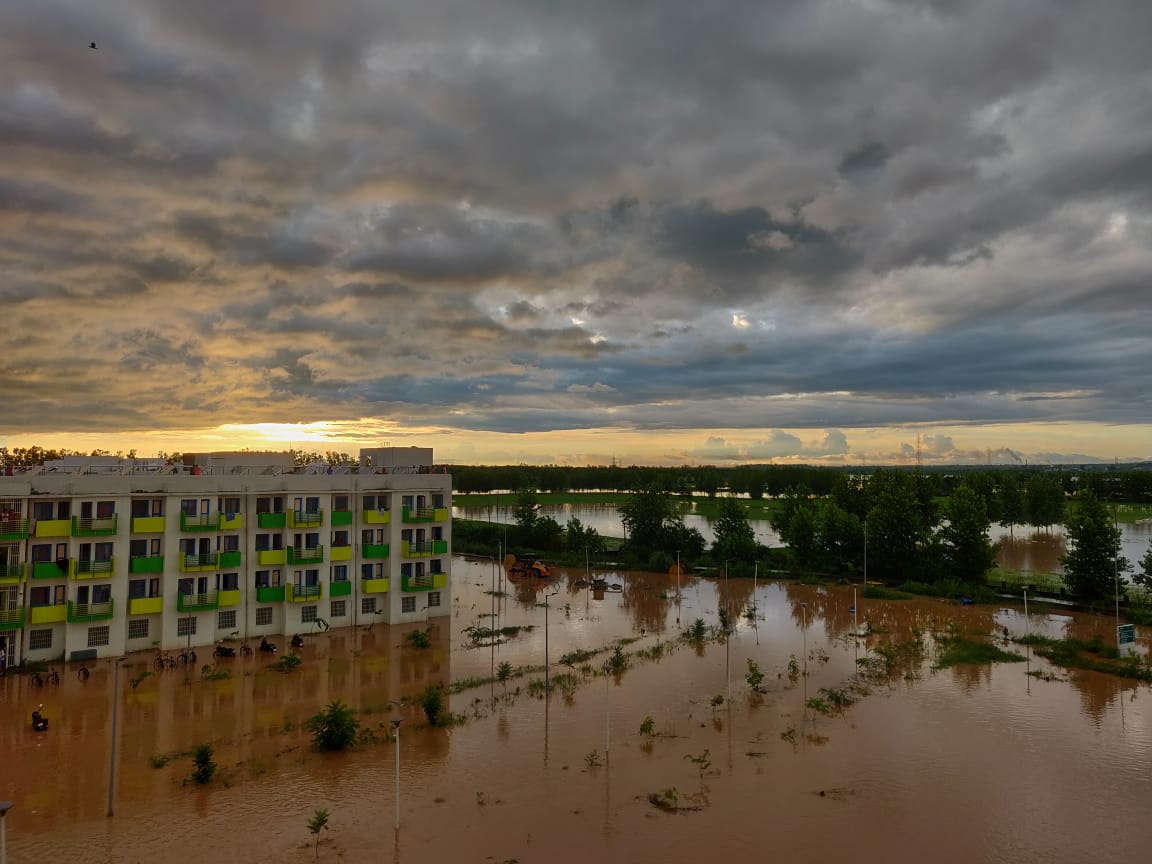
On 18 August 2019, Rupnagar saw the most devastating foods and waterlogging that submerged acres of land and displaced thousands of people. In a major event at IIT Ropar that witnessed huge scale waterlogging in the August 2019 floods, a team of researchers from the Geomatics Lab in the Department of Civil Engineering had carried out successful flood mapping using Space borne Active microwave remote sensing in the month of January 2020.
The study found mention in major newspapers across the state of Punjab as well as the country. Later as an extension to their work, the same team carried out run-off estimation of the 2019 floods, from the High-resolution Digital Elevation Model (DEM) generated from the satellite data. A research article on this has been published by the team with Environmental Monitoring and Assessment (EMAS), Springer Nature Publications on the 3rd February 2021. Thus, making the devastating floods of 2019 immortal in the times to come and documenting it for the future generations of tomorrow.
SAR (synthetic aperture radar) remote sensing with its high temporal resolution, all-weather data availability, and high spatial resolution, effectively and efficiently helps in high-resolution DEM (digital elevation model) generation and food inundation mapping and surface runoff estimation modelling. From this study, it was found that the higher the CN (curve number) value, the higher is the runoff.
It showed that heavy rainfall, cloud burst, and flash floods that occurred in the upper reaches of the Himalayas accumulated into causing a high surface runoff in the Rupnagar watershed and led to submergence of large chunks of agricultural lands and human settlements, calculated to be around 250 km². It caused the displacement of many people from their homes who were forced to take shelter in the upper reaches less affected by floods.
The areas near the Indian Institute of Technology transit campus and main campus were found to have high flooding potential owing to high CN values. The maximum runoff approximating to 350 mm was found in and around the two campuses of IIT Ropar in Rupnagar.
The team was headed by Dr. Reet Kamal Tiwari, Assistant Professor (Geomatics) and Head of the Geomatics Lab, Akshar Tripathi (PhD Scholar) and Luvkesh Attri (B.Tech, Final Year student); all from the Department of Civil Engineering at the Indian Institute of Technology (IIT) Ropar. Akshar Tripathi, said that since floods in India occur mostly in monsoon months with dense cloud cover, Active Microwave remote sensing with its all weather data availability and cloud penetration ability is an inevitable and reliable method for flood related studies.
Dr. Reet Kamal Tiwari called the 2019 floods a remarkable and rare event that teaches mankind to be prepared for Nature’s fury and Remote Sensing proves inevitable in such scenarios. Dr. Tiwari further adds that not only does Remote Sensing help to map the extent of such flood events but also does it aid to plan relief efforts and future settlements with its accuracy and robustness.
February 7,2021
